


 22 / 84

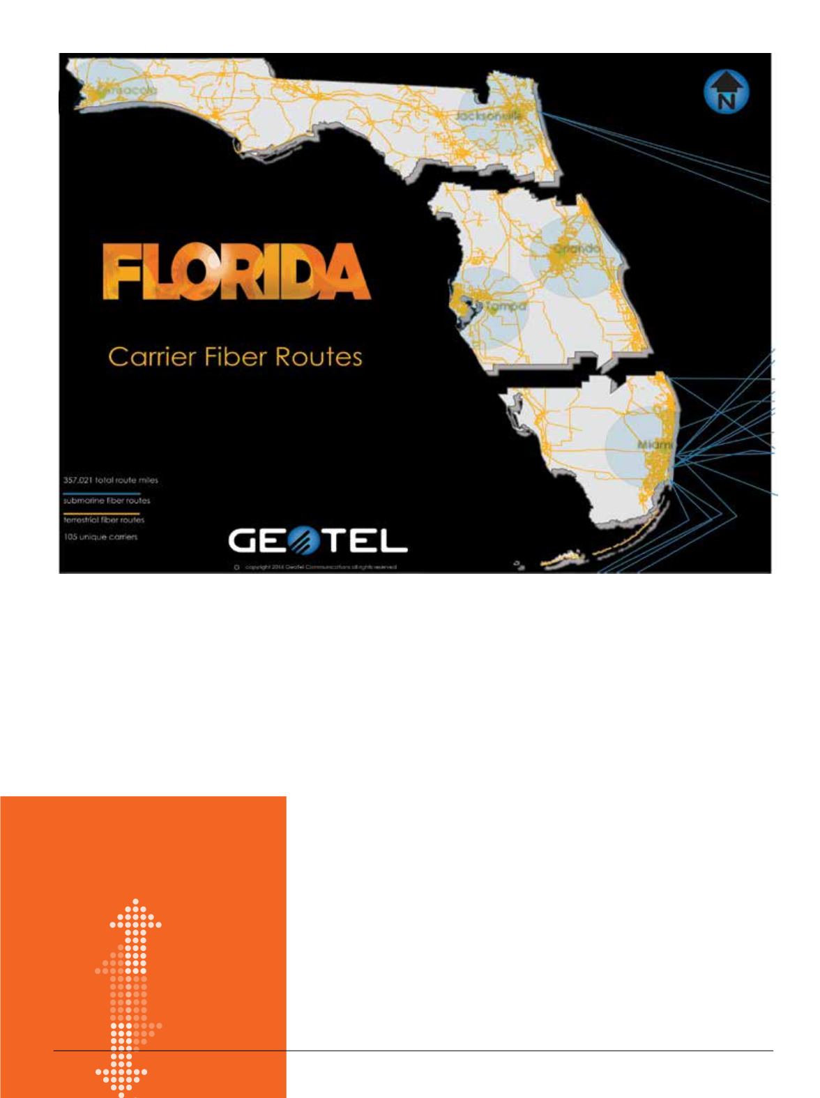
GeoTel Communications and
ChannelVison Magazine
have part-
nered to provide a telecommunications
related map or infographic in every
issue. These maps are created using
GIS (Geographic Information Systems)
software, analysts and skilled cartog-
raphers to produce commercial-grade
maps of fiber optic infrastructure from
around the world.
Each issue of
ChannelVision
will
now include a new map to view ranging
from fiber, cable and wireless infrastruc-
ture. In honor of summer, we start in the
Southeast with a map of carrier fiber
routes in the Sunshine State.
“GeoTel is honored to be given the
opportunity by
ChannelVison
to bring
its readers high quality telecom maps in
its print and online editions,” said Dave
Drazen, CEO of GeoTel. Maps also can
be purchased online by visiting the Geo-
Tel website. GeoTel can create and print
a variety maps and sizes of up to 5 ft. on
high-quality, semi-gloss paper.
GeoTel is a leading provider of tele-
communications location-based data-
sets in GIS and Internet-based spatial
technologies for more than 15 years.
By layering this data in GIS software or
by viewing it in one of the web-based
platforms, the company makes it pos-
sible to analyze detailed carrier fiber
routes and other telecom datasets
throughout North America. These
integrated datasets are digitized onto
high-quality street data and aerial im-
agery. GeoTel’s databases encompass
millions of miles of carrier fiber routes
from more than 605 different carriers,
more than 300,000 cell towers and
rooftop sites, and more than 1,400,000
on-net fiber lit buildings, data cen-
ters and central offices across more
than 7,000 U.S. cities. GeoTel currently
offers 15 different telecom datasets,
professional services and predictive
analytics of big data.
GeoTel will be releasing a SaaS
product exclusively for agents. A pay-
per-search feature will allow an agent
to quickly query locations based on
GeoTel’s database. Popular queries
include locating carriers in a building
and the carrier fiber routes that are
within 10 to 250 ft. of the building in
urban areas, and up to 1000 ft. in rural
areas. Agents also can engage GeoTel
for predictive analytic reports to better
understand market penetration, com-
petitive analysis, or several other types
of information.
On
the
MAP
Fiber in the
Sunshine
State
22
CHANNEL
VISION
|
July - August 2016